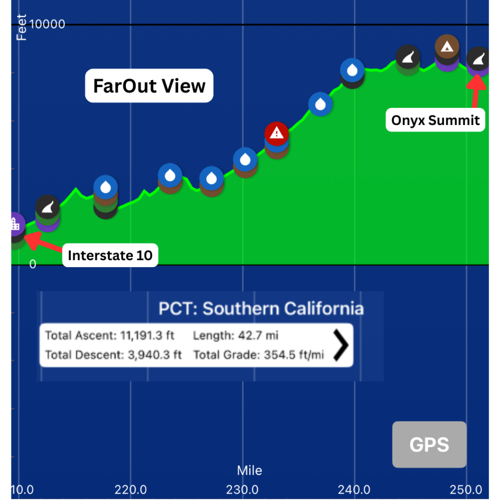
Interstate 10 to Onyx Summit
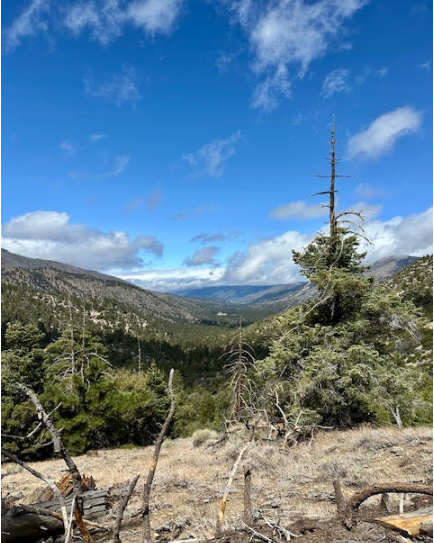
Section C: Big Bear, California
- Length: 42.6 Miles (Section Letter C)
- Duration: 3 nights, 4 days
- Highlights: Water, water, water.
- Difficulty: Hard, navigation challenges, rocky exposed trail, steep uphill climb.
- Season: Spring or Fall, lower elevation can be very hot!
Pros and cons:
- Pros:
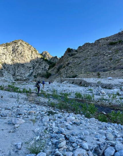
- Mission Creek is a constant water source.
- This leg has access points directly from major roads to the PCT – no extra spur trails are needed to connect making the logistics easier.
- Cons:
- Trail is washed out in many places around Mission Creek, this slows hikers down and causes navigation challenges.
Permits:
- A permit is NOT required for this leg.
Logistics:
- Start Trailhead: Interstate 10 (Mile 209.5)
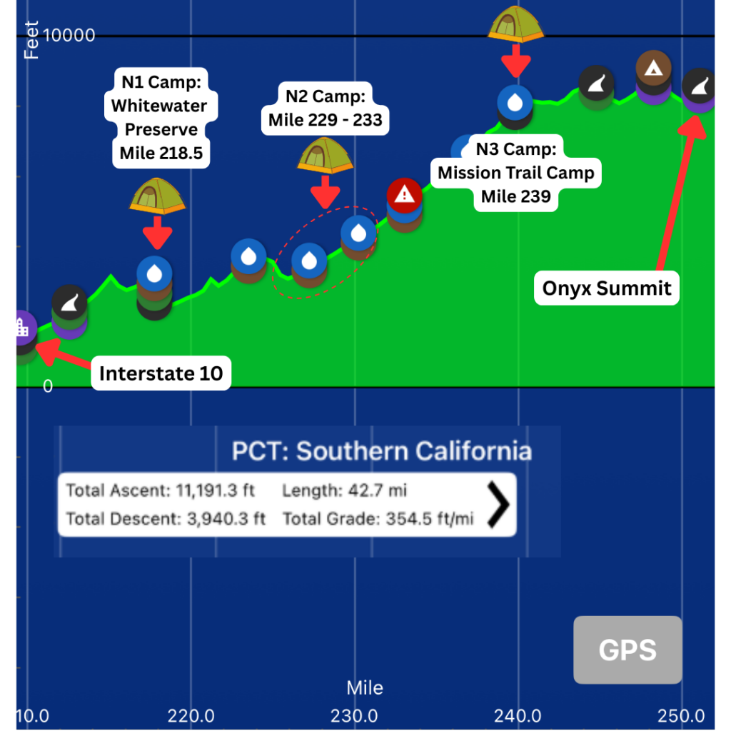
- Alternative Start: Whitewater Canyon Preserve, mile 218.5 (shaving 9 miles off the hike).
- End Trailhead: Onyx Summit (Mile 252.1)
- Parking: Free parking lot at Onyx summit, overnight parking is available.
- Transportation between the trailheads, contact Jazzy Bear Ride Service | Big Bear Lake, CA.
- A note on Jazzy Bear: Jazzy Bear is a business, not a trail angel, and their prices reflect the cost of operating and insuring a professional service. In my case, they drove me 1.5 hours down a windy mountain road—a long drive for anyone. I highly recommend this option if you’re not a seasoned thru-hiker or feel uneasy about getting into a car with a stranger (i.e., a trail angel, which is typically the only other option). The cost is comparable to the Southern Terminus shuttle, and possibly even a bit less expensive when you consider that they charge a flat rate per ride rather than per person. I paid $175 USD total; split between four people, that’s about $44 each. Personally, I’d rather pay for consistency and peace of mind. I understand this option may not be for everyone, but overall, my experience was excellent—and I would absolutely use them again.
Maps and Other Resources:
- Helpful information, including ride options, click here.
- For transportation to/from the trailheads, contact Jazzy Bear Ride Service | Big Bear Lake, CA.
- Check out YouTuber Liz Kidder’s video of this section.
Campgrounds and Zones:
- Whitewater Preserve: Spur to preserve is at mile 218.6.
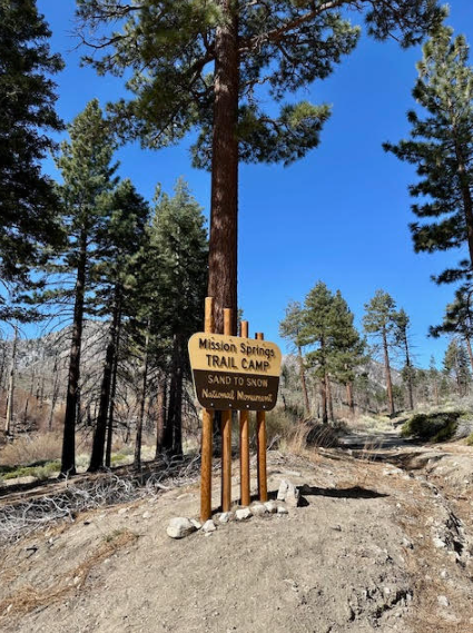
- Mission Trail Camp: Mile Spur to camp is at mile 239.9.
Itinerary:
3 nights and 4 days (NOBO)
Day 1:
- Interstate 10 to Whitewater Preserve
- 9.1 Miles Total
Day 2:
- Whitewater Preserve to Mile 229-233.
- 10-14 miles Total
Day 3:
- Miles 229-233 to Mission Trail Campground at mile 239.9
- 7-10 Miles Total
Day 4:
- Mission Trail Campground at Onyx Summit
- 12 Miles Total
Return to home page, click here.