Mount San Jacinto State Park and Wilderness
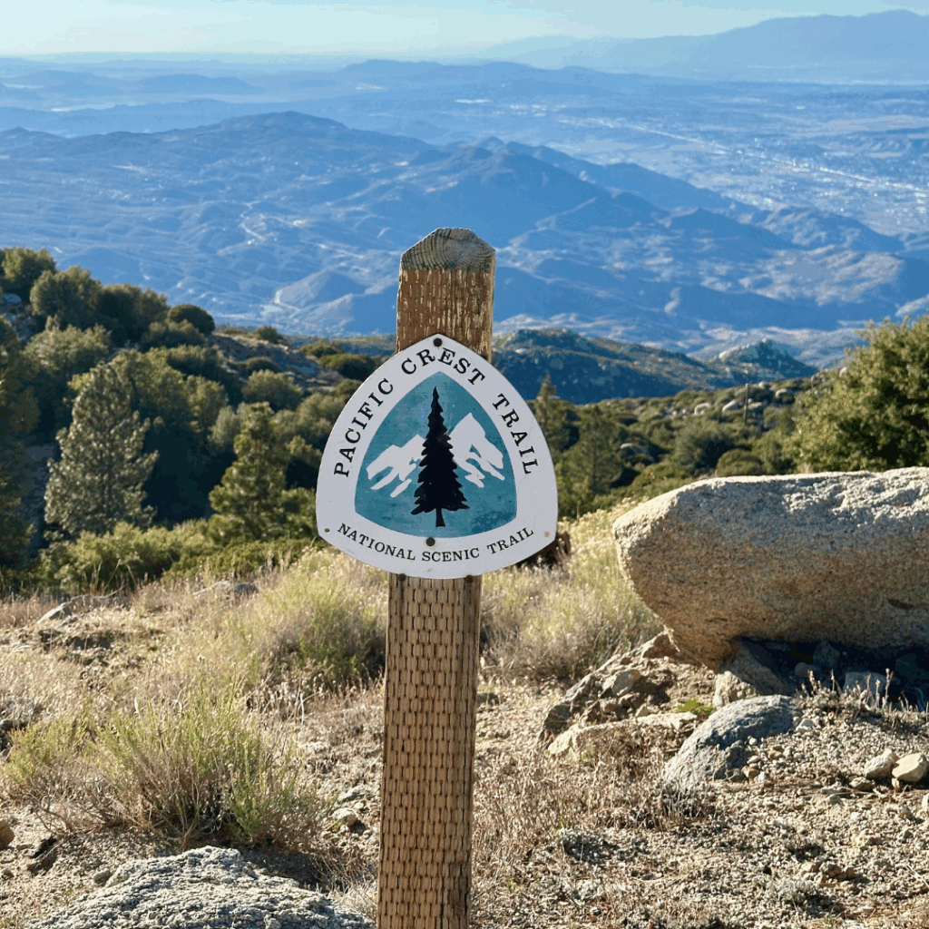
- Length: 29–36 miles
- PCT Miles: 179.4 – 209.5
- Duration: 2 nights / 3 days
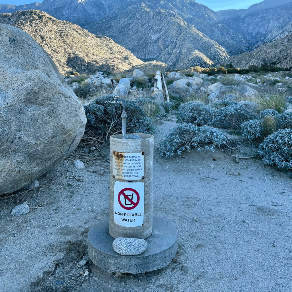
- Highlights: Idyllwild • Palm Springs • Fuller Ridge • Stunning alpine wilderness • Established campgrounds • PCT 200-mile marker • The most famous rusty pipe you will ever meet.
- Difficulty: Hard, weather challenges, significant changes in elevation.
- Season: This hike has a narrow weather window to get optimal conditions in both the mountains and the desert. We completed this stretch in mid-October. We had snow/ice at higher elevations with nighttime temps in the low 30s, while lower elevations reached into the high 80s.
Alternative Starting Points
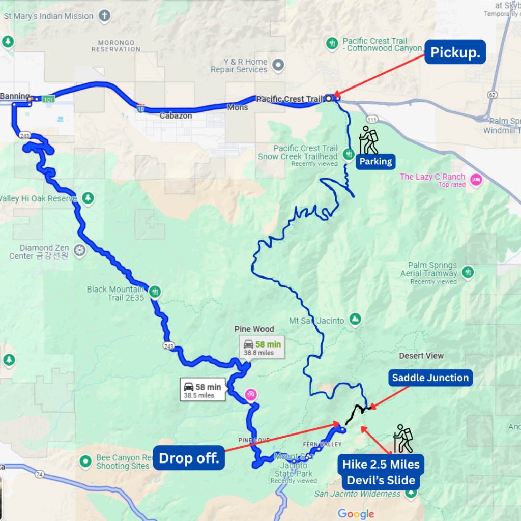
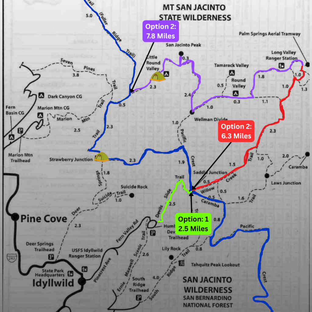
Option 1 — Devil’s Slide to Saddle Junction (Green Route)
• Hike 2.7 miles up Devil’s Slide from Idyllwild to reach the PCT at Saddle Junction (mile 179.4)
Option 2 — Tram Station to Saddle Junction (Red Route)
• Take Palm Springs Aerial Tram, start in Long Valley
• Hike 6.3 miles to reach the PCT at Saddle Junction (mile 179.4)
→ Avoids the grueling climb up Devil’s Slide
Option 3 — Tram Station to PCT Spur (Mile 185.7) (Purple Route)
• Take Palm Springs Aerial Tram and start in Long Valley
• Hike 7.8 miles to reach the PCT at mile 185.7
→ Includes the Mt. San Jacinto summit alternate (very popular!)

Pros & Cons
Pros
✅ Gorgeous alpine environment with stunning views
✅ Great “Sierra warm-up” terrain
Cons
⚠️ Permits required (mail-in is old-school!)
⚠️ Start is at 8,000+ ft — tram fee or steep climb required
⚠️ Weather swings between winter + desert heat
Permits
A permit is required to camp within Mount San Jacinto State Park.
Mail-in permits available in advance — include:
• $5 per person fee (check)
• Self-addressed, stamped envelope (return mail)
Walk-up permits available at:
• Park HQ at Idyllwild Campground (8am–4pm)
• San Jacinto Ranger Station in Idyllwild — open 24/7
• Long Valley Ranger Station (top of tram) — hours vary seasonally
📌 Recommendation:
If you have specific dates in mind, use the mail-in permit process — popular weekends sell out!
Logistics
Ending Point (all options):
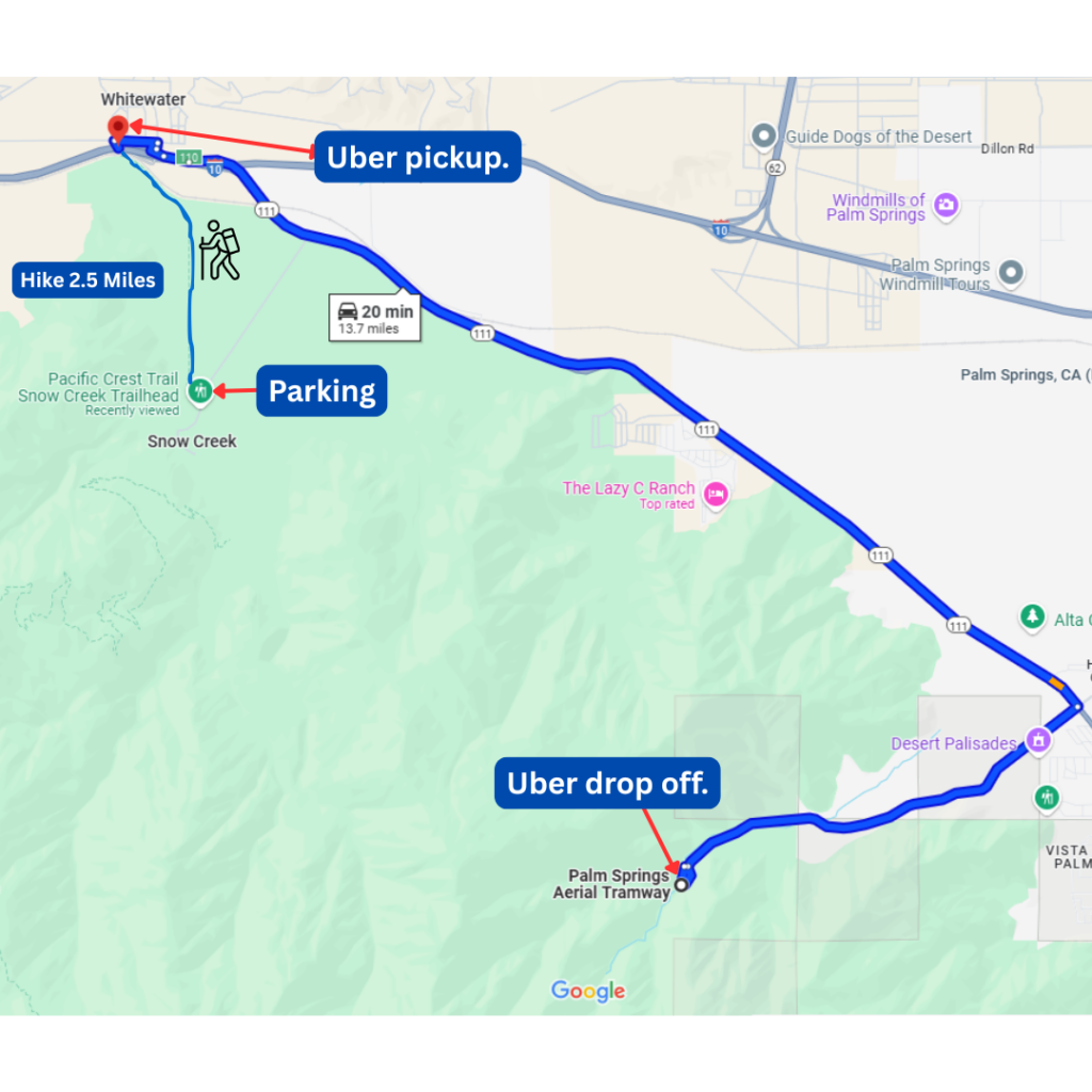
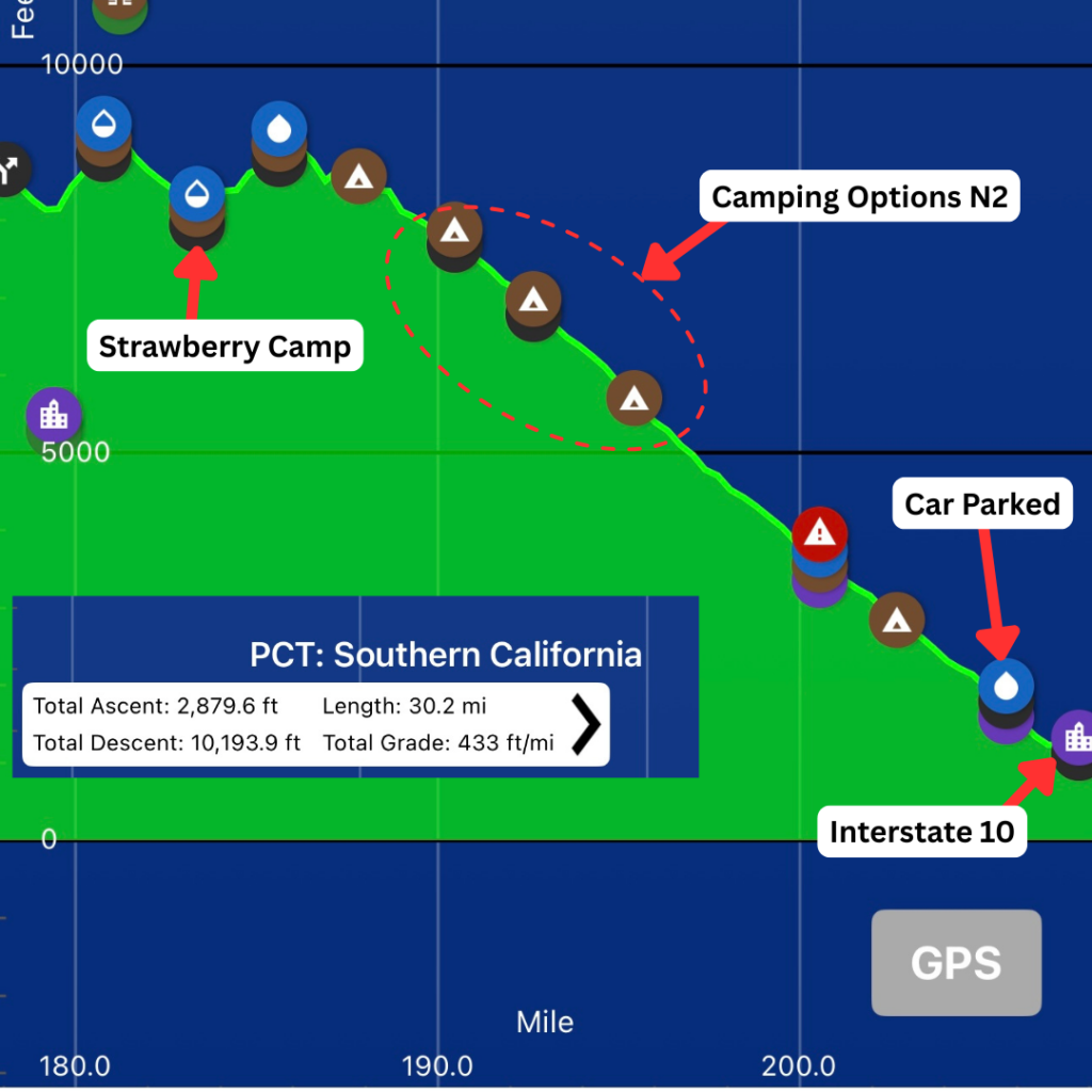
Snow Creek Trailhead at PCT mile 207
→ Optional: Continue 2.5 miles NOBO to Interstate 10 for a pickup spot
→ ⚠️ No parking at mile 209.5 — plan ahead
Transportation to Starting Points:
• Option 1: Connect with a local trail angel from Idyllwild
• Options 2 & 3: Uber/Lyft to Palm Springs Aerial Tram
Maps and Other Resources:
- Mount San Jacinto Trail Report.
- Mount San Jacinto State Park, click here.
- Helpful information, including ride options, click here.
Campgrounds within State Park (permit required)
$5 fee • Vault toilets • Max 15 campers per site • Open year-round
| Campground | Sites | Water |
|---|---|---|
| Round Valley | 19 | Spigot (may run dry) |
| Tamarack Valley | 8 | None listed |
| Little Round Valley | 6 | Sometimes |
| Strawberry Junction | 3 | Sometimes |
Suggested Itinerary — 2 Nights / 3 Days (NOBO)
Day 1 — Choose Your Start
Park at Snow Creek Trailhead → Shuttle/Uber/trail angel to your chosen start point:
🟢 Option 1 — Devil’s Slide (2.7 miles to PCT)
Start at Humber Park → Climb to Saddle Junction
🔴 Option 2 — Tram + 6.3 miles to PCT
Start at tram station → Hike to Saddle Junction
🟣 Option 3 — Tram + 8.7 miles to PCT (with peak)
Start at tram station → Summit Mt. San Jacinto → Join PCT at mile 185.7
📍 Campsite options:
• Strawberry Junction (Routes 1–2)
• Little Round Valley (Route 3)
Day 1:
- Once you reach the PCT via any of the options outlined above, take a moment to catch your breath, you should be around 8,000 feet.
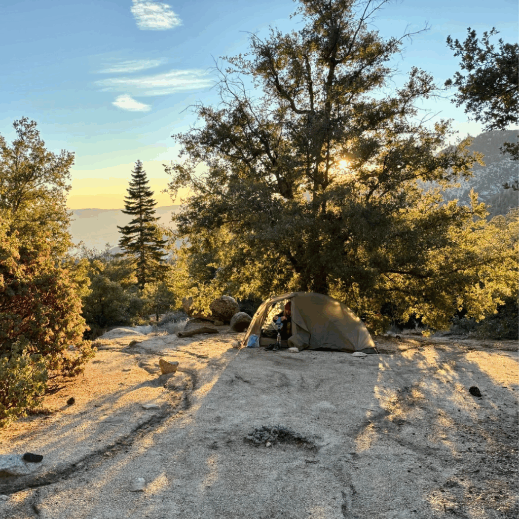
- If you choose routes 1 or 2, consider camping at Strawberry Junction, Mile 183.3 (permit required, $5).
- If you choose route 3, consider camping at Little Round Valley, just off the PCT (permit required, $5).
Day 2:
- Wake up refreshed — you’ll begin to descend from the alpine zone.
- This is the most enjoyable weather day, as you are not “too cold” or “too hot” in the alpine or desert zone… you’re just right!
- Excellent camping options between miles 193–197.
Day 3:
- The long descent begins — be prepared for heat!
- Shade is minimal, so take planned breaks.
- You’ll reach:
- 📍 The iconic rusty pipe at mile 205.5 — your first guaranteed water in ~20 miles
- 📍 Finish at Snow Creek Road, mile 207
Our approach:
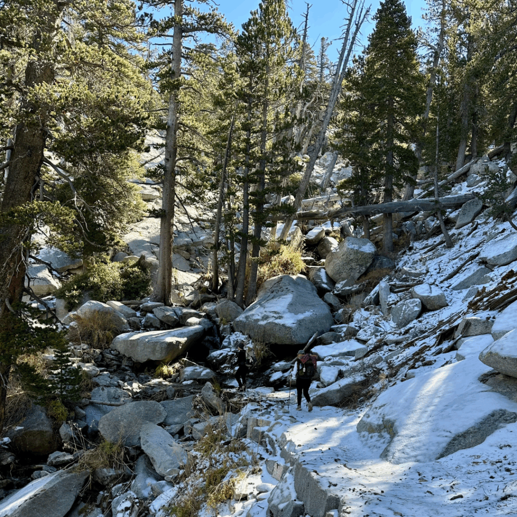
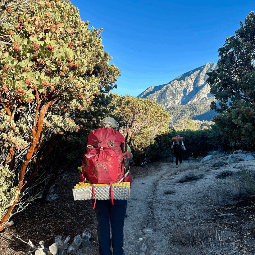
We selected Option 3 — tram + peak route. We camped at Little Round Valley on night one after hiking from Long Valley. In mid-October, we found snow and icy sections above 8,000 feet, with lows in the low 30s. We carried microspikes but didn’t end up needing them. The peak route was stunning and challenging with ~2,500 ft of gain. Abundant day-one water helped keep packs light.
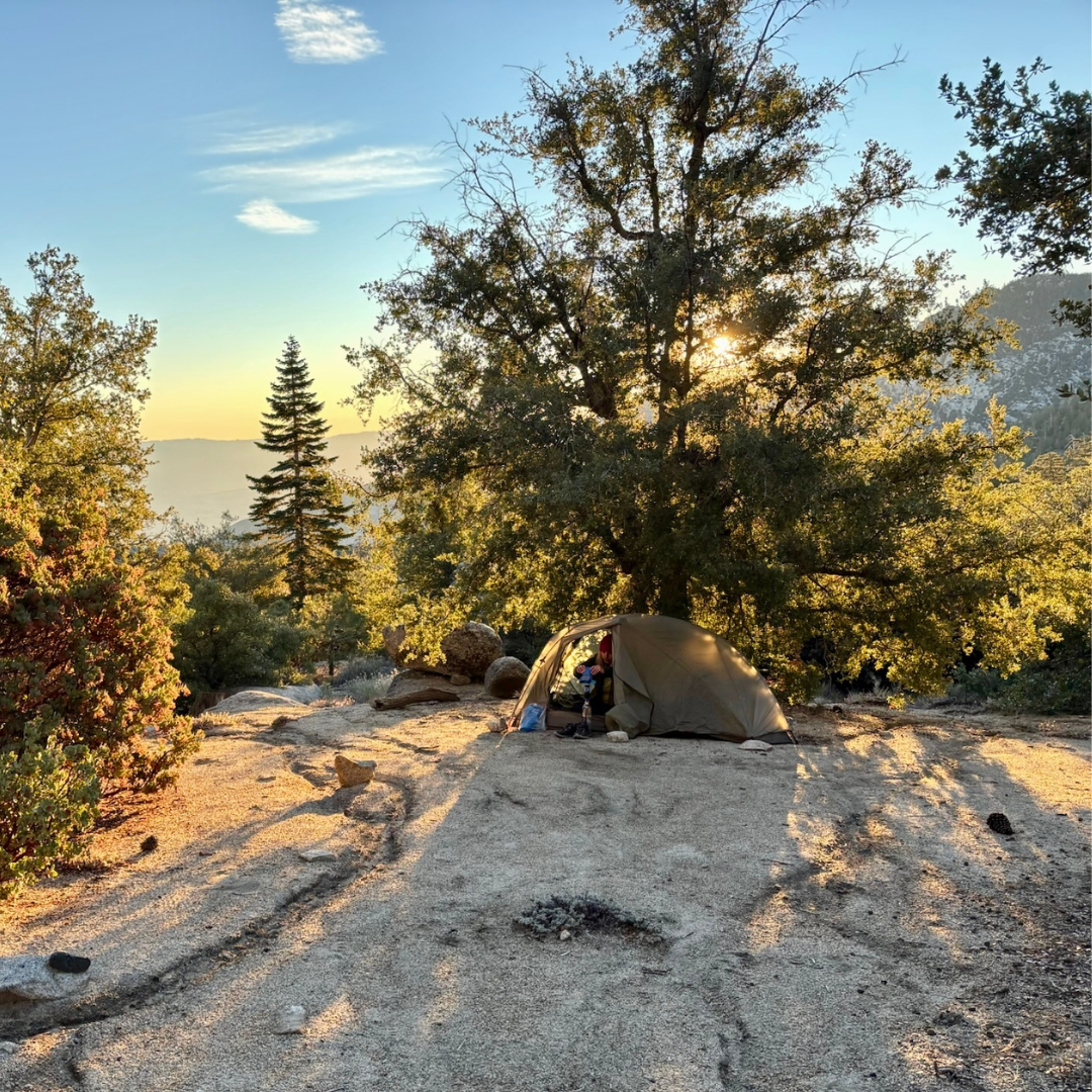
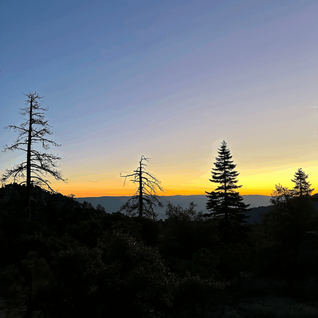
On Day 2, we hiked ~9 miles to PCT mile 193 — what a beautiful campsite! Protected from wind and placed perfectly for a breathtaking sunrise. The only water source available was the North Fork of the San Jacinto River at mile 186.2, which was a beautiful snowy waterfall. We camel’d up and prepared to carry water for the next 20 miles, including our dry camp.
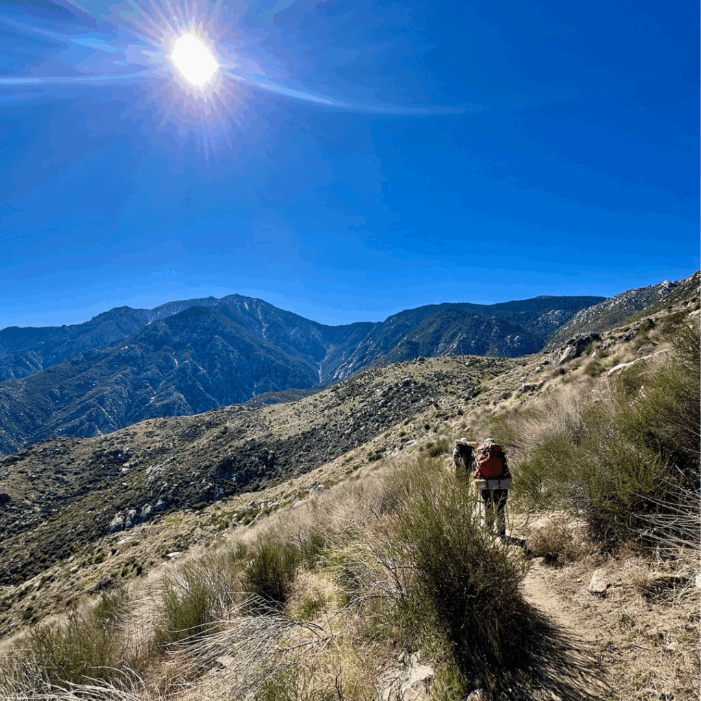
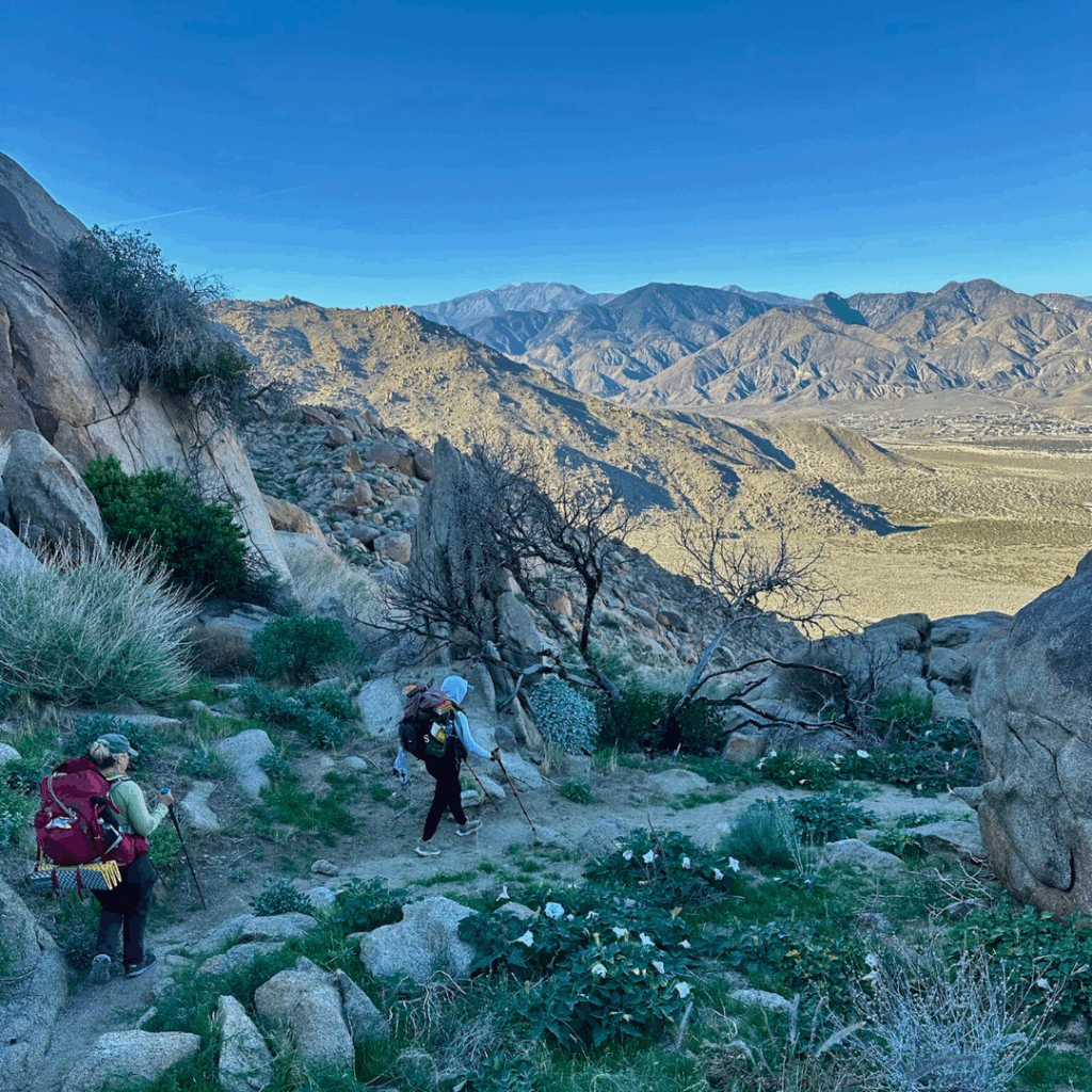
On Day 3, we pushed for 14 desert miles down to Snow Creek, resting in slivers of shade every hour. Temperatures climbed into the high 80s — a wild contrast to the first night. We saw almost no other hikers, but we did spot a tarantula and a rattlesnake (a real treat!). After endless switchbacks, we reached the famous rusty pipe and celebrated accordingly before hobbling to my car at mile 207.
Final Thoughts:
This section of the PCT has been on my list for ages and it exceeded every expectation.
Alpine pines one night and blasting desert heat the next.
Beauty, challenge, and a reminder of why we hike.
I’d do it again in a heartbeat.
Return to home page, click here.